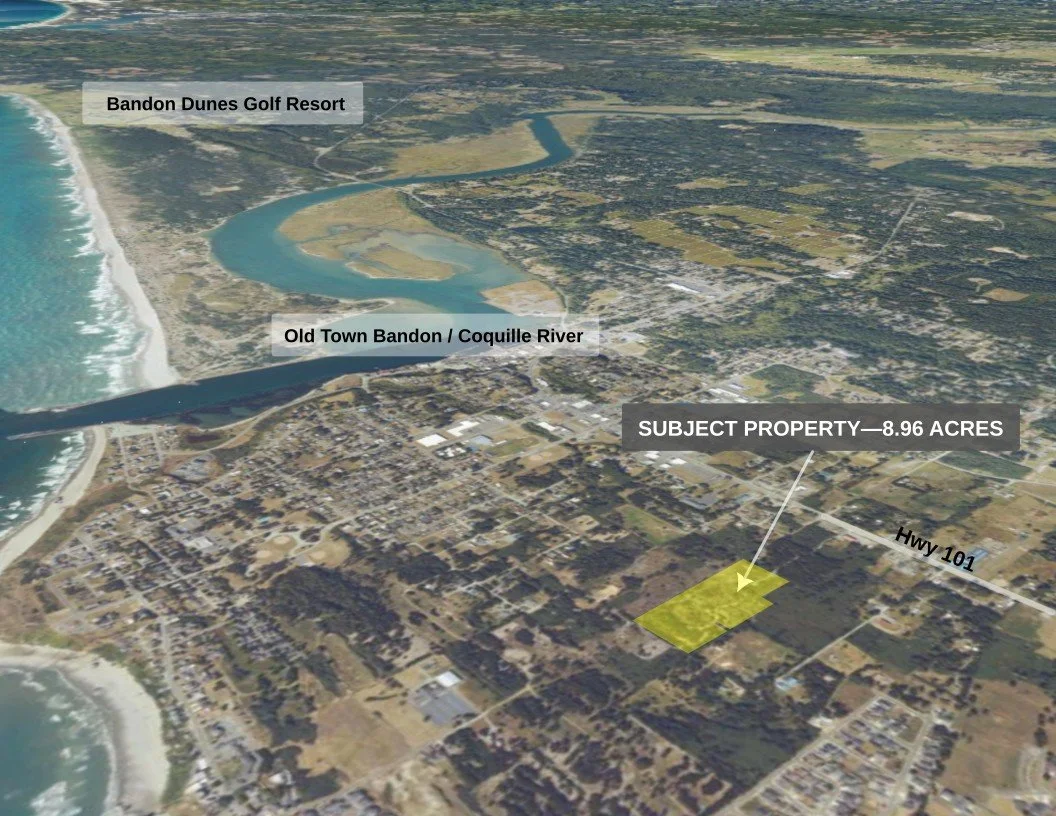
BANDON, OREGON • WEST OF HIGHWAY 101
Acreage at the Crossroads of Bandon’s West Side
Not remote coastal acreage. Face Rock Heights brings together 8.96 contiguous acres, existing county-permitted highway access, historic subdivision into 154 platted lots, and a strategic position within Bandon's planned west-side transportation network.
Rare 8.96 acres west of Highway 101
Planned transportation & utility corridor
Walkable to the beach
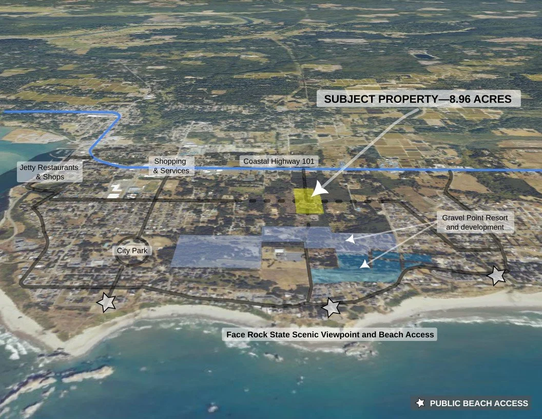
Positioned between Coastal Highway 101, the planned Gravel Point Resort/development area & the Pacific
NOW LISTED ON RMLS · MLS #413618349
Where Land, Location & Future Infrastructure Meet
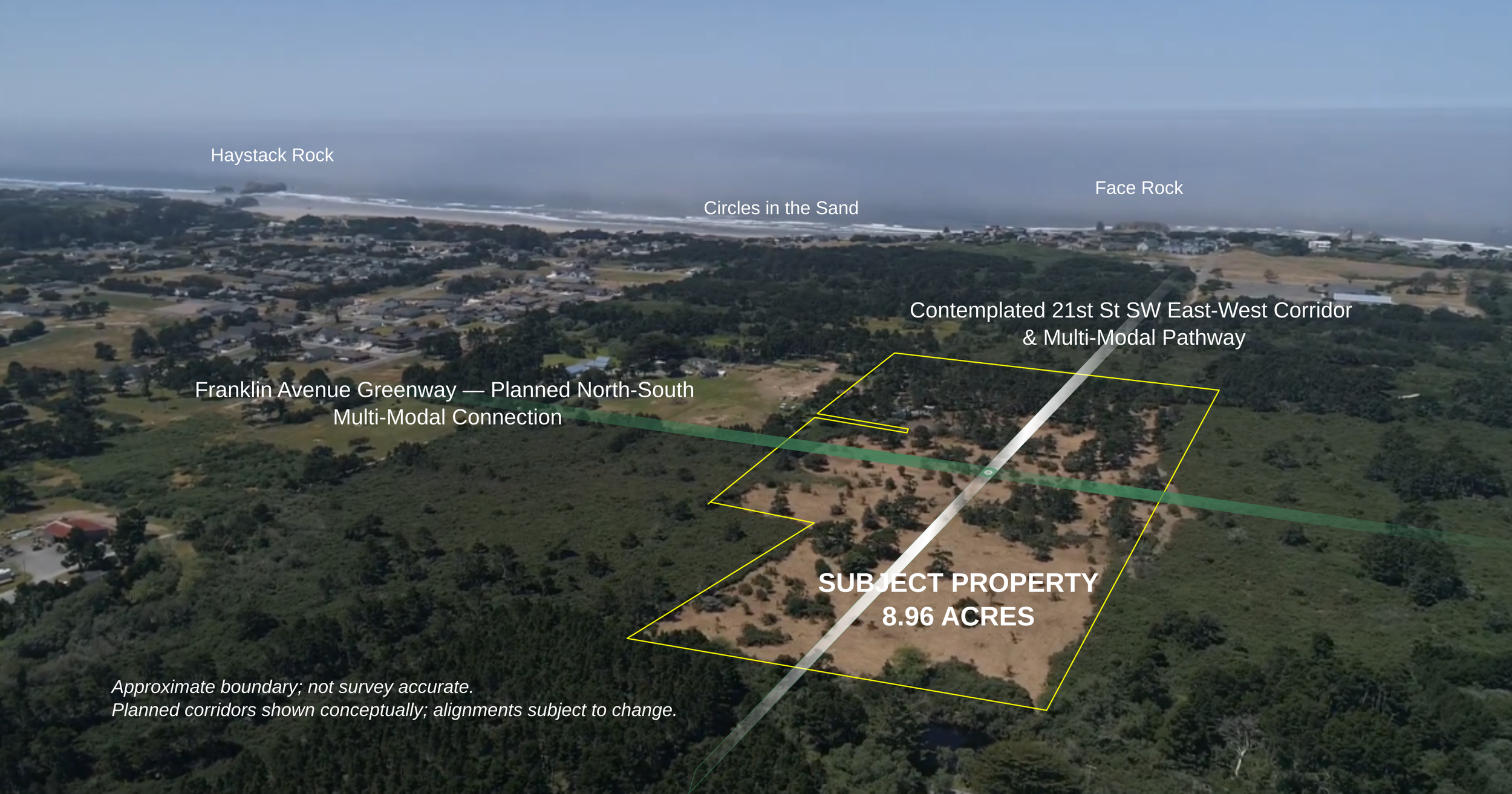
Nearly nine contiguous acres positioned at the intersection of Bandon's contemplated east-west transportation corridor and north-south Franklin Avenue Greenway.
A planned direct connection to the coast
Face Rock Heights occupies a strategic position between Highway 101, the developing Gravel Point area and Bandon’s oceanfront neighborhoods.
The contemplated 21st Street SW connection would create a more direct east-west route through the area, including pedestrian and bicycle access toward Face Rock Road and the coast.
Approximately ½ mile to the beach
From the subject-property boundary at 21st Street SW and Harrison Avenue, the contemplated route to the beach-access stairway at Face Rock State Scenic Viewpoint measures approximately 0.5 mile.