
The Opportunity
A Rare Position in Bandon’s West-Side Growth
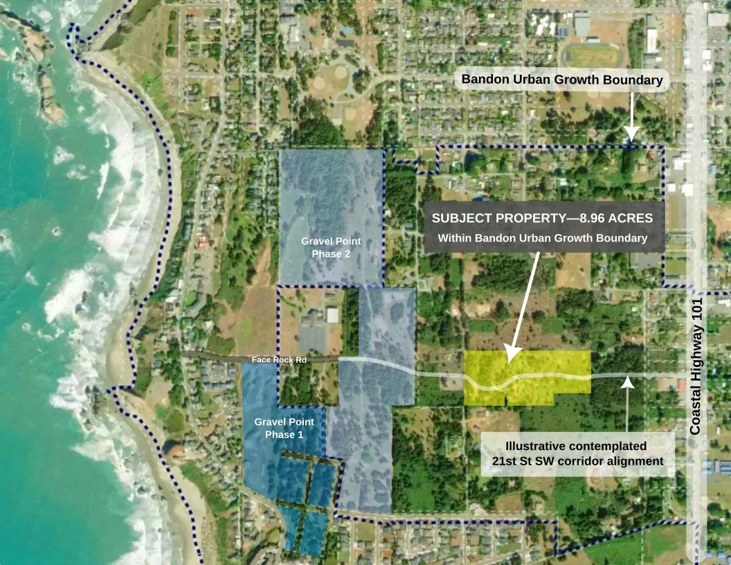
Face Rock Heights is more than coastal acreage. This 8.96-acre property combines substantial contiguous ownership, existing access from both east and west, and an underlying historic subdivision comprising 154 previously platted residential lots.
Located within Bandon's Urban Growth Boundary, the property also occupies an unusually strategic position within the City's planned west-side transportation network—between Highway 101, established coastal neighborhoods, and the developing Gravel Point area.
8.96 contiguous acres at the intersection of coast, community, and future infrastructure.
Coastal Acreage Without Coastal Isolation
The Oregon coast offers extraordinary properties whose principal value is seclusion, frontage and views. Face Rock Heights represents a different proposition: substantial acreage within Bandon's urban-growth framework, close to established services and recreation, with the beach forming part of a broader connected lifestyle.
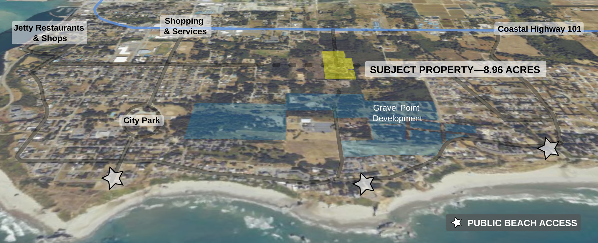
Not Ordinary Coastal Acreage—Several characteristics that are individually uncommon come together on one property.
8.96 ACRES WITHIN UGB
Substantial contiguous acreage west of Highway 101, inside Bandon's Urban Growth Boundary.
EXISTING ACCESS FROM TWO DIRECTIONS
Positioned inside Bandon’s Urban Growth Boundary, with future annexation, zoning and development treatment subject to City review and approval.
County-permitted 21st St SW gravel access from Highway 101 to the east, plus Harrison Road access serving the homestead to the west.
HISTORICALLY PLATTED LAND
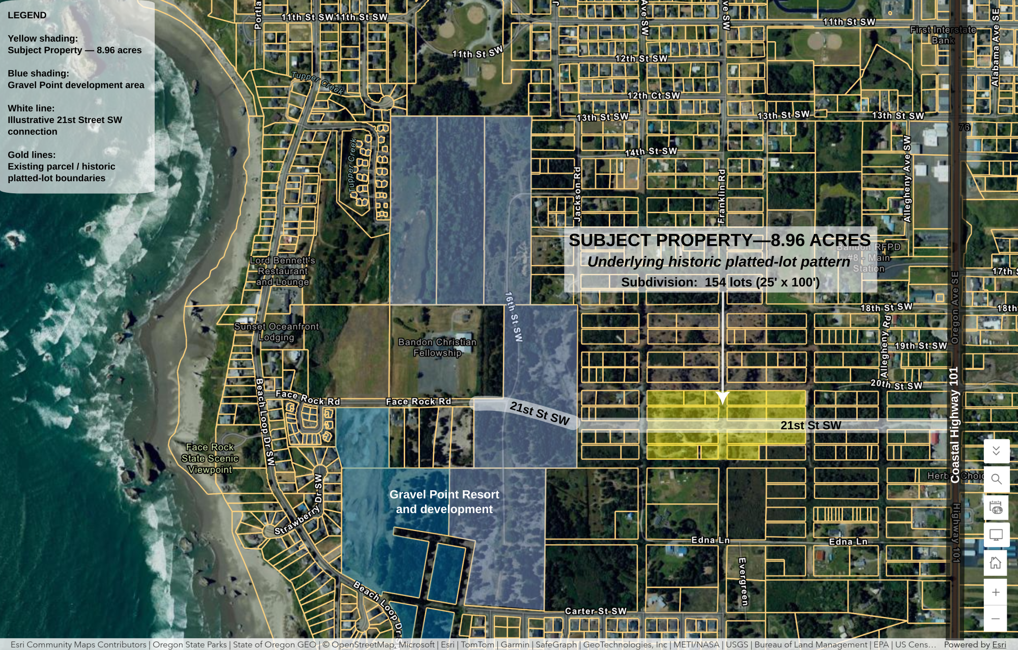
Five tax parcels encompass 154 previously platted residential lots, generally measuring 25 × 100 feet.
STRATEGIC CORRIDOR POSITION
Positioned within Bandon's planned west-side transportation network, including contemplated east-west and north-south connections.
A property at the crossroads
The underlying map tells an unusual story. What appears today as one contiguous 8.96-acre property sits within a much older pattern of small platted lots and streets.
At the same time, Bandon’s current transportation planning is bringing new east-west and north-south connections into this same area. The result is a property positioned not at the edge of future infrastructure, but directly within the emerging network.
Whether the ultimate east-west connection follows 20th Street SW or 21st Street SW changes the physical impact on the property—but not its strategic position.
An opportunity to think bigger
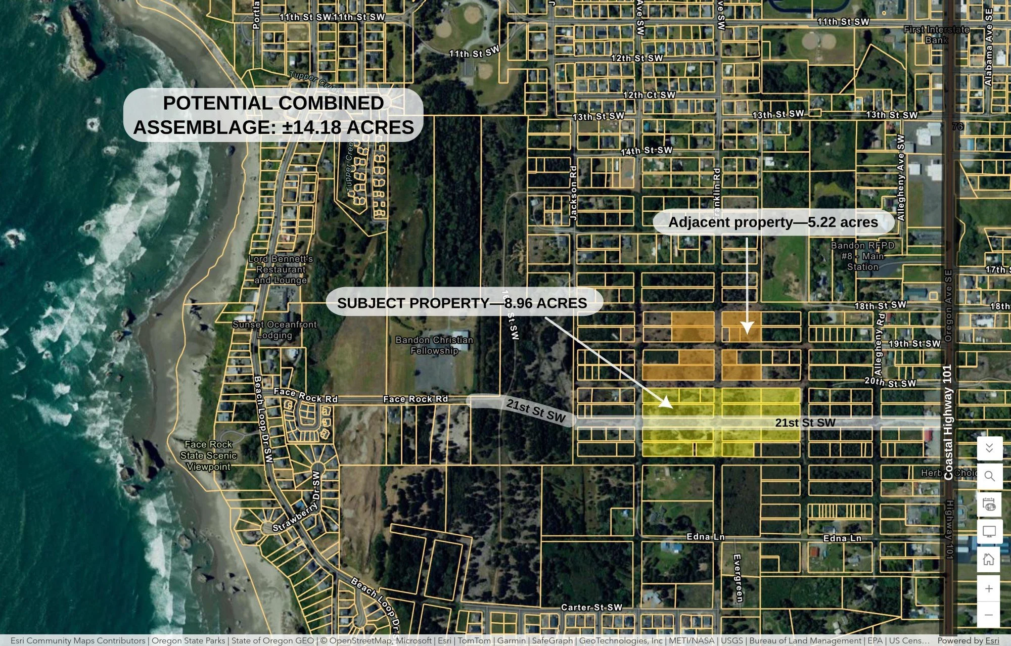
A separately owned 5.22-acre property immediately north of Face Rock Heights and partly adjoining it creates an additional assemblage possibility.
Acquired together, the two properties would comprise approximately 14.18 acres in this same west-side growth area.
The 5.22-acre tract is not part of the Face Rock Heights offering and would require a separate acquisition from its owner.
An area in transition
For decades, Face Rock Heights was heavily overgrown with coastal gorse. Extensive clearing has since revealed the property's scale, generally level terrain, and relationship to surrounding development.
Clearing, surrounding land assembly, Gravel Point planning and development, transportation planning, proposed construction access and future utility infrastructure have progressively changed the context in which this property sits.
The opportunity is therefore not simply to acquire acreage near the Oregon coast. It is to acquire a substantial tract while the surrounding transportation, infrastructure and development framework is still taking shape.
Explore the property in detail
Review the property’s parcels, underlying platting, transportation framework, zoning context, utilities and planning information.