
Documents
Property Information for Review and Due Diligence
Property Information & Supporting Materials
Face Rock Heights combines 8.96 contiguous acres within Bandon's Urban Growth Boundary, established access from both Highway 101 and Harrison Road, and an underlying historic subdivision of 154 previously platted residential lots. Its strategic position at the crossroads of Bandon's planned west-side transportation network offers significant long-term connectivity and infrastructure potential.
The materials below are intended to provide prospective buyers, developers, and their advisors with progressively deeper levels of information — from a concise property overview to the complete Seller’s Assessment and supporting source material.
Seller’s Assessment: Comprehensive Property & Market Analysis
Update: October 22, 2026 — 57 pages
The Seller’s Assessment is the principal reference document for the property.
It brings together the property’s physical characteristics, location, existing parcel and plat configuration, transportation planning, utility context, nearby Gravel Point development, comparable land evidence, development considerations, and the seller’s valuation analysis.
The report also includes maps, aerial imagery, transportation graphics, historical market evidence, source notes, and supporting documentation.
Best for: buyers, developers, land planners, brokers, lenders, appraisers, attorneys, and others conducting detailed review.
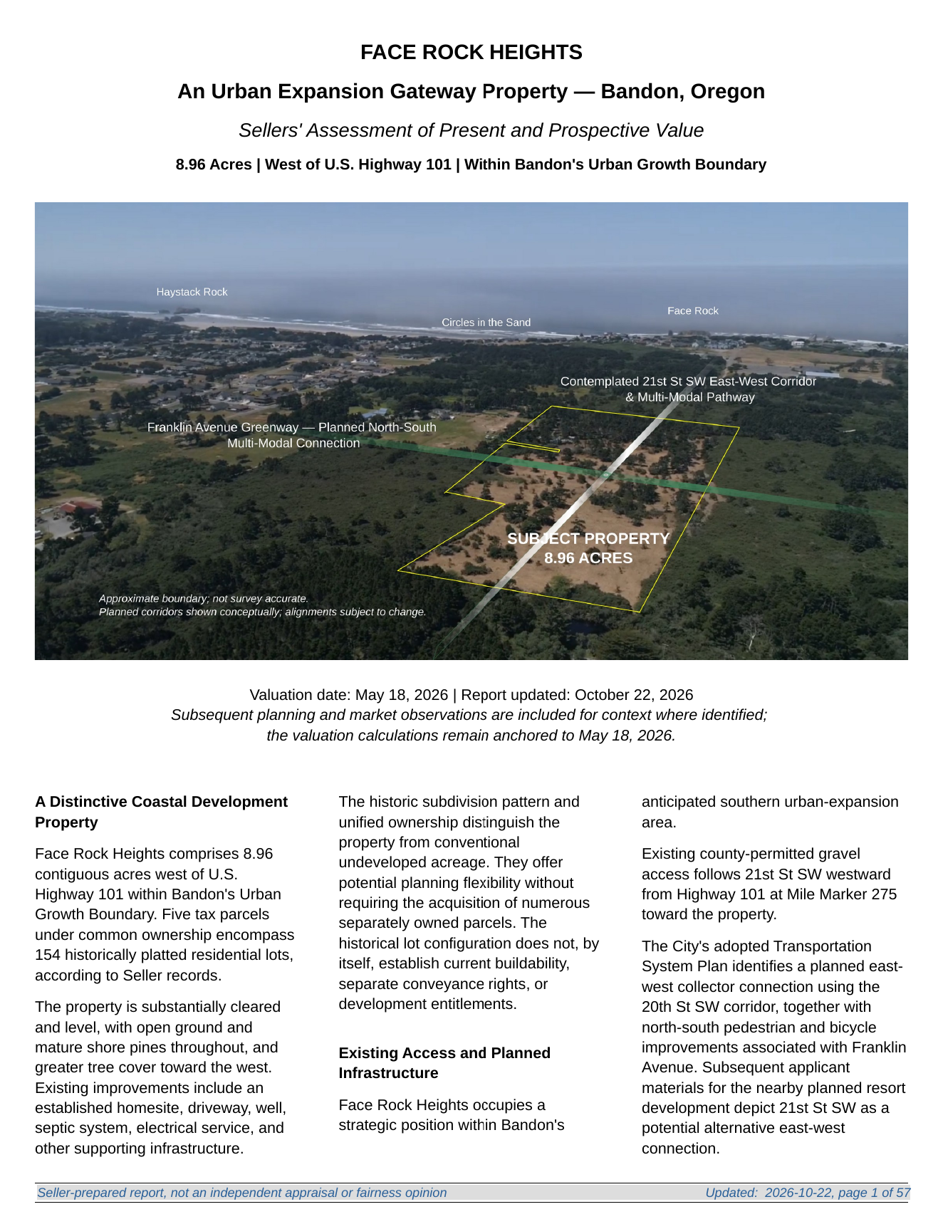
Select image to download
Property Overview
Concise 2-page summary
This concise overview provides the essential property facts at a glance, including:
approximately 8.96 acres west of Highway 101 in Bandon
strategic location within the emerging Face Rock Heights area
potential 21st Street SW transportation and utility corridor
approximately one-half-mile contemplated route to the beach via the 21st Street SW connection
adjoining and nearby development context
historic subdivision comprising 154 previously platted residential lots
established property access from two directions: Highway 101 via 21st St SW and Harrison Road.
key site-condition and development highlights
Best for: initial review, forwarding to partners, and quick internal discussion.
Offering Overview
Expanded 8-page property presentation
This expanded offering overview bridges the gap between the two-page Property Overview and the full Seller’s Assessment. It includes the strongest property graphics and a concise discussion of:
the opportunity
strategic location
transportation and utilities
site conditions
development context
nearby Gravel Point activity
beach access and walkability
scarcity of comparable acreage
property and transaction information
Best for: buyers who want substantial information without initially reviewing the complete 39-page assessment.
Maps, Sources & Supporting Information
Additional source materials, public-agency references, maps, historical imagery, and documentation are incorporated throughout the Seller’s Assessment and elsewhere on this website.
For visitors who want to explore the property visually, the website also includes dedicated pages covering:
The Opportunity · Site Conditions · Property & Planning · Drone / History · Sources & Disclaimers
Downloads:
A Note About These Materials: These documents are seller-prepared informational and marketing materials. They are intended to assist prospective purchasers in understanding the property and its surrounding development context. They are not a substitute for independent investigation, professional advice, surveys, engineering, land-use review, title review, environmental review, or verification with applicable governmental agencies. Prospective purchasers should independently verify all information material to their intended use of the property.